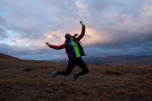
 I am finally getting back into a groove after my move to Colorado and weeks of home improvement tasks. I even when to Orangetheory this week for the first time in way too long. It was tough — way tougher than when I was going regularly — but it was so, so good to be back. Definitely planning to go more often, especially as we have these rainy and colder days of fall. Maybe I’ll even do Hell Week this year… Anyway, the purpose of this post is to recap some (but not all!) of the fun running and hiking adventures I’ve had over the past several weeks: (1) completing the Boulder Skyline Traverse (previously mentioned here); (2) summitting Mt. Bierstadt (our 2nd 14er); (3) summitting Grays and Torreys Peaks (our 3rd and 4th 14ers); and (4) joining the Boulder Trail Runners for one of their infamous Sunday “Church” runs. Also don’t forget you can stay up to date on these adventures and much more on Instagram. Let’s dig in…
Boulder Skyline Traverse
The Boulder, Colorado skyline has five main peaks: South Boulder Peak (8,549 ft), Bear Peak (8,459 ft), Green Mountain (8,150 ft), Flagstaff (6,983 ft), and Mt. Sanitas (6,835 ft). The Boulder Skyline Traverse is a route that connects all five peaks into a single 16-20 mile run (depending on exact route) with over 5,000 ft of elevation gain.

I set out with a friend at about 6:30 am on Labor Day weekend. We stashed my car at the Centennial Trailhead (this is the trailhead for Mt. Sanitas), and parked her car at our starting point — the South Mesa Trailhead. We watched the sun spread across the early-fall colors of South Boulder (see above) and then headed up our biggest climb of the day: Shadow Canyon to South Boulder Peak. (Here is an overview of the route that we followed for the most part.) Now is probably a good time to mention that Labor Day weekend in Boulder this year was approximately 10 million degrees. More on that later. The morning was pleasant and we felt a nice burning of the legs as we paced ourselves for all that was ahead. As we approached the rocky, wildfire-burnt South Boulder Peak, we saw our best wildlife sighting of the day: a “trail chicken!” (Apparently actually a grouse.) After tagging our first peak, we traversed over to Bear Peak for #2. (What is nice about the traverse is that you don’t ascend and descend each peak independently.) After tagging Bear, we crossed over and met up with some friends near Green. We snapped selfie at the iconic summit marker. Woohoo. I was feeling hot but good. Three of the peaks were done, and they were the big ones. Just little baby Flagstaff and then a final push for Sanitas, I told myself. We ran over to Flagstaff (hiked uphills but tried to run the flats and downhills). Flagstaff doesn’t really have a cool summit spot, but we took a selfie anyway.
At this point I was feeling OK but was warm and getting low on water. I had ordered a bladder for my new-ish UD Jenny pack but the Amazon gods failed me, and I didn’t get it in time. So I had only the two soft flasks in the front. I had filled one with Nuun and one with water, but in the heat of the day, it wasn’t nearly enough. I had to go about three miles in the peak heat of the day without water, until we finally arrived at the oasis that is Eben G. Fine Park. I filled up my bottles 72 times, drank until I could drink no more, and also snacked on some goodies. I hadn’t been eating while I was low on fluids, because who wants to eat a dry Stinger Waffle without water to wash it down? So I stood blankly at the park in total bonk mode waiting for the sugar to hit me and the water to course its way through my veins. And that was when my friend mentioned that we had to summit Red Rocks. Red Rocks is this strange sandcastle-looking rock formation next to Sanitas. The rocks sit on what is called Anemone Hill. So although it doesn’t count as one of the peaks, we had to climb up from Eben G. Fine to the rocks, and then down to Centennial Trailhead for re-stocking our supplies, trail beers, etc. before the final climb up Sanitas. The easier west side of Anemone Hill was closed, so I very, very slowly trudged up the steeper east side. All the normal, non-Skyline-Traversing people probably thought I was nuts because I looked so dead at this point walking up what is really not a particularly large hill.
We took a quick stop at the car at the Centennial Trailhead, and my friend — who was clearly more prepared than I was — shared some magnificent, cold Thomcord grapes with me, while she sipped a pre-Sanitas beer. When we felt refreshed enough (aka not at all fresh), we headed out up Sanitas. Sanitas is totally exposed to the sun, which was cruelly beating down on my bonked body. As hikers passed my ailing, flailing body I felt compelled to yell I’VE ALREADY DONE FOUR PEAKS AND FIFTEEN MILES, OK!?!? I once again got low on water, and my my friend mercifully shared an electrolyte packet that I mixed with the few remaining drops of water in my soft flasks. The super-concentrated citrus salt was manna from heaven, and we finally made it to the top. I told my friend that if the summit was 10 more steps, I might not have made it. Maybe I was being dramatic. We decided to descend via Lion’s Lair, which is a longer but more mellow route. I shuffled along pathetically.
Finally we made it back to the car, 8.5 hrs after we started. Traverse complete! Lesson learned: bring more water!
Mt. Bierstadt
When my husband and I decided to move to Colorado, one of our first purchases was an awesome 14ers poster from Etsy. Colorado has 53 peaks that qualify as 14ers because they tower at least 14,000 feet above sea level and rise at least 300 feet above the saddle of the closest 14er. The poster we bought is a checklist, and while we probably won’t end up checking off them all, we thought it would be fun to start checking off a few. (I clearly have an obsession with checking things — such as states, mountains, etc. — off lists.)
We hiked our first 14er, Quandary Peak, during a past trip to Colorado. For our second 14er, I chose Bierstadt, which is considered a little bit harder than Quandary because it has some boulders to climb towards the summit (making it a Class 2). It also happens to be pretty darn close to Boulder/Denver, just a little over 1.5 hrs, off I-70. We had heard that parking was limited and the mountain gets crowded later in the day, so we arrived at the trailhead just before 6. We started the hike with our headlamps, but within an hour the sun was peering over the mountains and revealing the orange color of the alpine bushes around us. Sawtooth Ridge, which connects Bierstadt to Mt. Evans, another 14er, cast a striking silhouette.

We could see some clouds in the distance, but the forecast called for partially cloudy conditions, so I wasn’t surprised. (Photo above.) We felt pretty warm and even talked about being able to sit at the summit for a while, which we didn’t do at frigid, sleeting Quandary. As soon as the words came out of my mouth, snow began to fall lightly. This was a little surprising because there was no precipitation in the forecast, but hey, it’s the mountains; this happens. Once we could see the summit in the distance, not too far away, another hiker asked how far we thought we were; she pointed to some clouds that were making her nervous. We figured we had about 40 more minutes to go, and I wasn’t worried about a little snow. We got to a flat spot before the final push up, and the snow started falling harder. The final push is over some boulders and rocks — there is no marked trail at this point — and they were getting slippery, so we had to carefully navigate and use our hands a bit.
Our step onto the summit felt synchronized with the arrival of the snow cloud and all its mighty winds. We couldn’t see a thing. We took our selfie with the wind whipping snow across our faces, only a few close-by boulders in sight. Not quite the image we had hoped for… The few others on the summit were nervous and said they wanted to quickly descend. Not knowing what else the weather had in store, we followed them. We were glad that we weren’t alone, as we looked through the whiteout for dark figures ahead of us to know we were going the right way. We took it cairn by cairn and soon were relieved to be back to the solid trail, even though the wind was still biting and visibility was extremely poor. We saw folks continuing to ascend — some apprehensively, others in shorts — and were glad that we weren’t faced with that decision. Several folks decided to turn around without summitting when we told them that it was cloudy and slippery at the top. Always a tough situation because everyone needs to make their own decision, but I’m never going to be in the position of encouraging someone to continue if they are unsure about the conditions.
Of course about 30 minutes after we came off the summit, the sun came out from behind a cloud, and you could see straight to the top. The colors below were magnificent. Those people probably had a great backdrop to their selfies…
But the clouds came in and out for the rest of the hike, and the wind really picked up. We were frozen by the time we got back to the car and were grateful for early starts and heated seats. Check it off!
Grays and Torreys
After our adventure on Bierstadt, I wanted to get at least one more 14er done before winter. We opted for another set of close-by mountains: Grays and Torreys. We set out on a Saturday (9/30), and although we knew it had snowed on Friday and would snow more on Saturday afternoon, the forecast was clear for Saturday morning. A running friend also joined us for this adventure. These two peaks are just a few minutes past the I-70 exist for Bierstadt, up a BONKERS bumpy jeep road. We were glad to be in the SUV with good clearance, and glad the ground wasn’t wet or snowy. We arrived at the trailhead at about 6:30 am and there were still a few parking spots left in the tiny parking lot. Even from the trailhead, the view was striking, with Grays and a huge ridge covered in snow. We were expecting cold conditions, so we were sure to pack more layers than what we had worn for Bierstadt. And good thing! After a mile or two of dirt and a little ice, we were in snow for the rest of the hike. Oh, and the wind gusts… crazy. I felt at times like we were in an Everest documentary, with the snow blowing all around us.
We set up the Grays trail, trying our best to step our feet into the footprints and post-holes that had been created by the hikers who came before us. In many spots, however, the wind had blown the snow around and covered up the trail. Luckily, we could see hikers and the general path ahead; just a little more work when you are breaking trail. I thought about putting on my Yaktrax to help get traction in the snow, but they are really better for ice or packed snow vs. powder, so I kept them in my bag for the ascent of Grays. The most awkward spots going up were where the trail went along the edge of the slope, so that we were walking along the edge rather than up it. Our outside feet sometimes slipped when we stepped into the snow, but it didn’t feel so severe that we might fall off the side of the mountain.

We made it to the top of Grays and decided that it would be a pretty straightforward 14er if not for the snow. We snapped a selfie from the beautiful, clear peak, with lots of snow-capped mountains in the distance. I had read that the trickiest section of the Grays-Torreys hike was coming off of Grays and going towards Torreys. This rumor was true, especially in the snow. We took note that the route going over to Torreys was less crowded than the route going down Grays; it appeared many folks were opting not to add Torreys to their adventure that day. But we had come this far, and Torreys is only about another half mile across the saddle. So we took a few cautious steps down the steeper side of Grays, into the saddle. Once I gained a little confidence, this descent was the highlight of the trip for me. We slid and “skied” down to the low point between the two mountains. I fell on my butt approximately 394 times. Luckily I landed in several inches of powder. I tried to follow the sparse footsteps of previous hikers, but there was some trail-blazing happening as well, resulting in full-leg-snow-sinking.
At the base of Torreys, we could tell that the snow was much more mild, and we took the steep but straightforward hike up to the summit. We saw two baby bears running along the side of the mountain — I think this was MY FIRST WILD BEAR SIGHTING!!!! I thought they were dogs or large, fast marmots and I stupidly asked a fellow hiker “What are those?!” without really thinking it through. He was nice and just replied “Um those are baby bears.” Right. We snapped our second summit selfie, strapped on our Yaktrax for the icier hike down, and went on our way.
From the bottom of the saddle, we had to cut across to meet back up with the Grays Trail. Again there was sliding and post-holing and butt-falling, but we could see our destination and other hikers at all times, so it wasn’t scary. When we reached the trail, I sat down in the snow and watched my husband and friend come down, wishing someone had Go-Pro-ed the snowy descent. Back on the Grays Trail, the path was much more packed after several hours of hikers stepping on it — nearly unrecognizable from the deep snow we had trudged through in the morning. We walked down the snowy path and finally hit the mud and then the parking lot. A full, fun day in the mountains. As we left, the clouds were starting to roll in, and we were glad to be done before any new snow came. It would have been a totally different hike — and much scarier — if visibility had been limited.
Church Run
I have done several runs with the Boulder Trail Runners but had never joined them for their Sunday “Church” runs, which are usually epic long runs in awesome places. With the high country runventuring winding down for the season, I decided this week was the week to “go to church.”
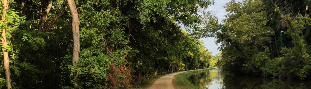
The dozen or so runners met at the Justice Center and carpooled to the Sunshine Saddle, our starting point. We started down into and across Lefthand Canyon, then up, up, up over Gold Ridge (I’m guessing so-named due to the insane yellow foliage!) and down Slaughterhouse Gulch into Jamestown, Colorado, a cute town. There, we stocked up on fresh water (learned my lesson during the Traverse!), Boulder Canyon potato chips, and a vegan nice cream sammy.
After leaving Jamestown, we ran/hiked along the James Creek Drainage, which included several creek crossings on log bridges that luckily held up (see below). Our final crossing did not have a bridge, and we spent several minutes trying to find the best place to cross the fast-moving creek. I gave up and walked straight through one of the more gentle spots of the creek, without attempting to keep my feet dry. After exiting the drainage area, we turned our soggy feet onto a forest road, back to the top of Slaughterhouse Gulch, and back to the trailhead.

We did a total of 19 miles and about 3,700 ft of elevation gain (over the course of 6 and a half hours… yeesh). I caught up with some friends, met some new people, peeped some truly beautiful autumn leaves, and got in a legit long run! Amen.
Have you hiked a 14er or gone on some awesome Colorado adventure I need to check out? Have you ever hiked in the snow, and if so, was it awesome or terrible? What are your tricks to deal with running in the heat and/or bonking?

Pingback: Year in Review: 2017 | athlettuce
Pingback: Quad Rock 50 Training (T Minus 14 Weeks); Two Weeks Until the Austin Marathon; Post-Whole30 Check-In | athlettuce